Moseley-Norfolk Lightguide (Phillips) route
Updated: 04:54PM EST 05/25/2004
Comments:
This route is an early fiber optic upgrade of a much older, suspected
coaxial cable route that connected the Moseley and Norfolk switches. Route
markers can be clearly seen crossing Rt. 40 and dotting numerous farms in
Sussex County as well as crossing Nansemond Pkwy. adjecent to Bell Atlantic's
Driver CO. Facility spacing is unknown but more huts are suspected to exist
since the distance between M-N MH84 and M-N MH38 is roughly 44 miles. That kind
of repeater distance is just now being put into use with
cutting edge DWDM transmission technology. Currently only
Qwest and the AT&T/PF.net next generation backbone employ repeater spacing
of 35 to 60 miles (AT&T/PF.net and Qwest respectively).
Hut IDs probably refer to route markers. Although there are no signs of any
modern fiber optic match stick markers there certainly are not 84+ regenerator/
OP-AMP sites along this route. Furthermore, MH is a common telco abbreviation
for manhole cover and these suspected repeater facilities may be nothing more
than sheltered manhole covers.
Route facilities:
| Facility | Site |
|---|
| Site ID: | Moseley |
| Location: | NW/O 20425 Duval Rd.
Skinquater, Chesterfield Co., VA |
| Picture Date: | 04/09/2004 |
| Comments: | 4ESS Tandem, hardened underground site |
|
 |
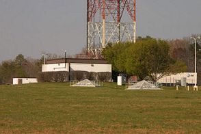
| Site ID: | M-N MH84 |
| Location: | 23631 Cherry Hill Rd.
Dinwiddie Co., VA |
| Picture Date: | 08/03/2001 |
| Comments: | Adjacent to AT&T DeWitt microwave relay |
|
 |
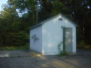
| Site ID: | M-N MH38 |
| Location: | 3511 W. Blackwater Rd.
Isle of Wight Co., VA |
| Picture Date: | 05/22/2004 |
| Comments: | full size image roughly 108kb! |
|
 |
| Site ID: | Norfolk 1 |
| Location: | 120/132 W. Bute St.
Norfolk, VA |
| Picture Date: | sometime in 2000 |
| Comments: | Hardend switch site |
|
 |


