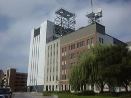
| Site ID: | Richmond 1 |
| Location: | 703 Grace St. Richmond, VA |
| Picture Date: |
| Site ID: | R.I.C. KS |
| Location: | Rt. 1 & Happy Hill Rd. area Chesterfield Co., VA |
| Picture Date: | N/A |
| Comments: | Demolished |
| Site ID: | N.R.F.? K4W |
| Location: | ? Prince Geogre Co., VA |
| Picture Date: | |
| Comments: |
| Site ID: | N.R.F.? K3W |
| Location: | ? Surry Co?, VA |
| Picture Date: | |
| Comments: |
| Site ID: | N.R.F.? K2W |
| Location: | ? Isle of Wight Co.?, VA |
| Picture Date: | |
| Comments: |
| Site ID: | N.R.F? K1W |
| Location: | Chuckatuck area? Suffolk, VA |
| Picture Date: | |
| Comments: |
| Site ID: | Norfolk 1 |
| Location: | 120/132 W. Bute St. Norfolk, VA |
| Picture Date: | sometime in 2000 |
| Comments: | Hardend switch site |